
News · Now live
The Grand Est Water Observatory is live
The Grand Est Region launches its shared regional water-data platform — to centralise, harmonise and publish information on the resource for elected officials, technical experts and citizens alike. A platform designed and operated with Melis Platform.
The platform
Here is the Grand Est Water Observatory in production
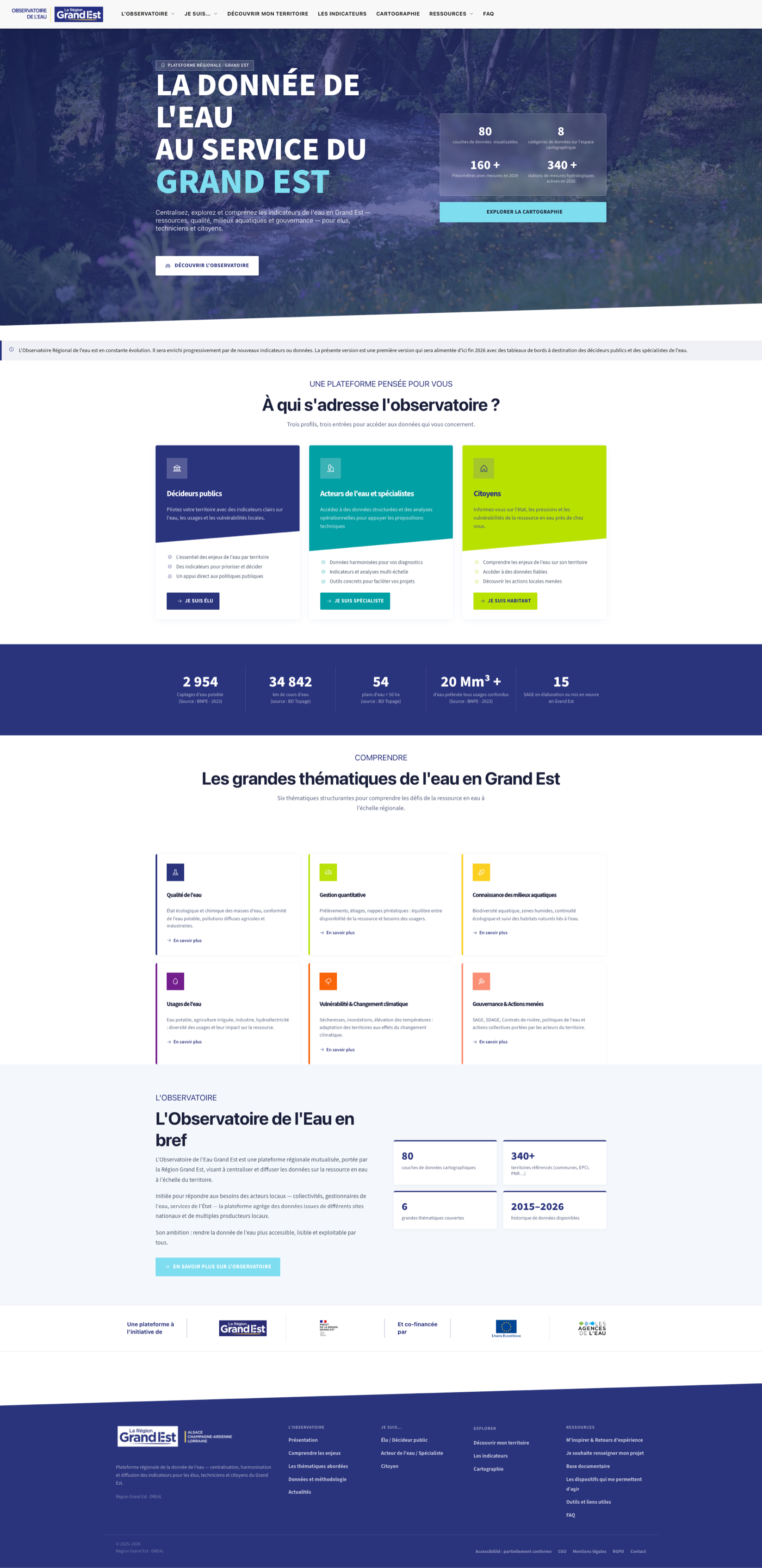
observatoire-eau.grandest.fr — the homepage, with the key figures and the three entry profiles right from the landing view.
The platform in figures
A region's water data, finally in one place
The project
A shared regional platform for water data
Led by the Grand Est Region, the Regional Water Observatory is a shared platform built to centralise, harmonise and publish data on the water resource across the territory — from the springs of Champagne to the aquifers of Alsace.
Initiated to meet the needs of local stakeholders — local authorities, water managers and State services — the platform aggregates data drawn from several national portals and from many local producers. Its ambition: to make water data more accessible, readable and usable by everyone.
Centralising data that until now was scattered across dozens of producers, and making it readable for an elected official and a citizen alike: that was the whole point of the observatory.
At a glance
The challenge
Bringing scattered, multi-source data together — and making it readable
Water data exists — but it is fragmented: between national portals, State services, water agencies and local producers, everyone publishes in their own formats. The observatory had to clear several hurdles:
- Aggregate heterogeneous sources (national water-withdrawal, hydrographic, subsurface, piezometer and quality datasets…) into a common reference
- Harmonise very different formats and scales to make them comparable
- Serve three audiences with distinct needs — from expert analysis to citizen outreach
- Map it all in a smooth, open and accessible interface
All on an open, evolving foundation, able to host new indicators and dashboards year after year — without depending on a proprietary building block.
A platform designed for you
Three profiles, three ways into the data
Everyone reaches the data that concerns them — at the right level of reading.
Public decision-makers
Steer your territory with clear indicators on water, its uses and local vulnerabilities.
- The essentials of water challenges by territory
- Indicators to prioritise and decide
- Direct support for public policy
Water stakeholders & specialists
Access structured data and operational analyses to back up your technical proposals.
- Harmonised data for your diagnostics
- Multi-scale indicators and analyses
- Concrete tools to ease your projects
Citizens
Learn about the state, pressures and vulnerabilities of the water resource close to home.
- Understand water challenges in your area
- Access reliable data
- Discover the local actions under way
Understand
Six themes to decode water in Grand Est
Structuring themes to understand the challenges of the resource at the regional scale.
Water quality
Ecological and chemical status of water bodies, drinking-water compliance, diffuse agricultural and industrial pollution.
Quantitative management
Withdrawals, low-water periods, groundwater: the balance between resource availability and the needs of users.
Aquatic ecosystems
Aquatic biodiversity, wetlands, ecological continuity and monitoring of natural habitats linked to water.
Uses of water
Drinking water, irrigated agriculture, industry, hydropower: the diversity of uses and their impact on the resource.
Vulnerability & climate
Droughts, floods, rising temperatures: territories adapting to the effects of climate change.
Governance & actions
Water management schemes, river contracts, water policies and collective actions led by territorial stakeholders.
At the heart of the platform
Explore, cross-reference, get inspired
Overlay data layers across the whole Grand Est region
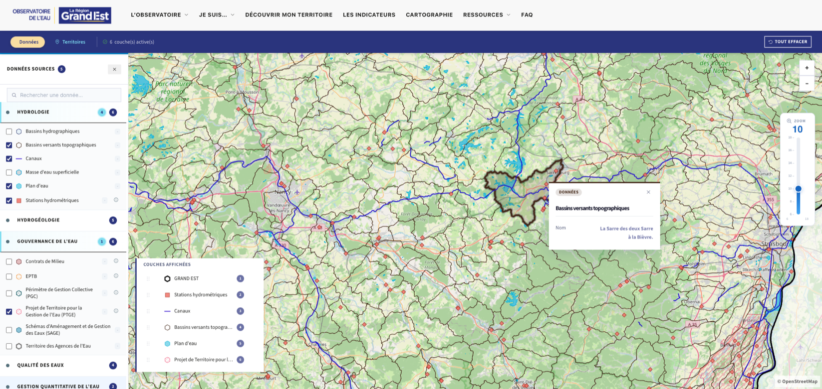
Hydrographic basins, groundwater bodies, piezometers, quality monitors, hydrometric stations: each layer toggles on demand over an open base map, from watershed down to municipality.
Place every issue within its governance perimeter
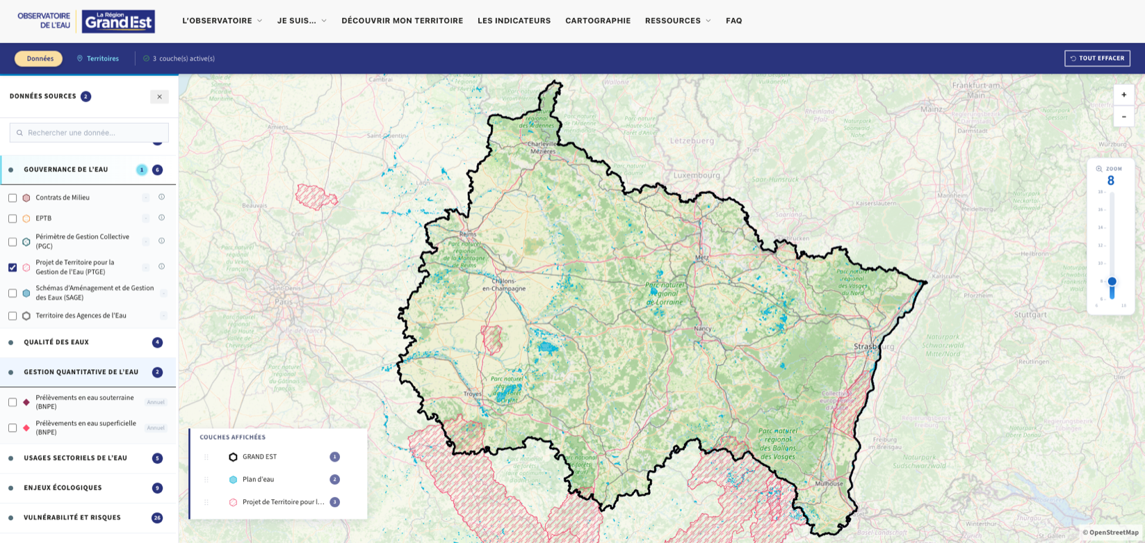
River basin contracts, water management schemes, territorial water plans, water-agency perimeters: governance layers put every indicator in the right frame of action, against the right local stakeholder.
Get inspired & field feedback
A library of concrete projects led across the territories — river restoration, de-paving, leak detection, rainwater harvesting — sorted by theme and open to contributions.
- Field-feedback stories filterable by theme
- Schemes that help you take action
- A documentary base and useful links
Summary
What the observatory delivers
Water data brought together, readable and open — at the service of an entire territory.
| Objective | Result |
|---|---|
| Centralise regional data | 80 cartographic layers brought together |
| Harmonise multiple sources | 8 comparable data categories |
| Serve three distinct audiences | Officials · specialists · citizens |
| Track the resource over time | 2015–2026 history made usable |
| Build an evolving foundation | Dashboards to be added by end of 2026 |
A collective project
Led by the Region, co-funded by its partners
The observatory is a platform led by the Grand Est Region, co-funded by the State, the European Union and the Water Agencies — and set to grow progressively with new indicators and dashboards for public decision-makers and water specialists.
In summary
A public resource — open and built to last
The Grand Est Water Observatory shows how a public authority can turn scattered data into a readable public service. With Melis Platform, the Region achieved:
- A single platform for previously scattered sources
- Three levels of reading for three audiences
- An open, accessible interactive map
- An evolving foundation, ready for the dashboards to come
Building a data portal?
Observatory, open-data platform, territorial portal: Melis helps you centralise, harmonise and publish your data on an open, sovereign foundation. Request a demo or talk to our team.